5 Backpacking Trips in Utah that Don’t Require Permits
#1 Dark Canyon Wilderness Loop - Bear Ears National Monument
Distance: 56 miles
Level of Difficulty: Strenuous
Elevation Gain: 3,759 ft
Best Season: Spring and Fall
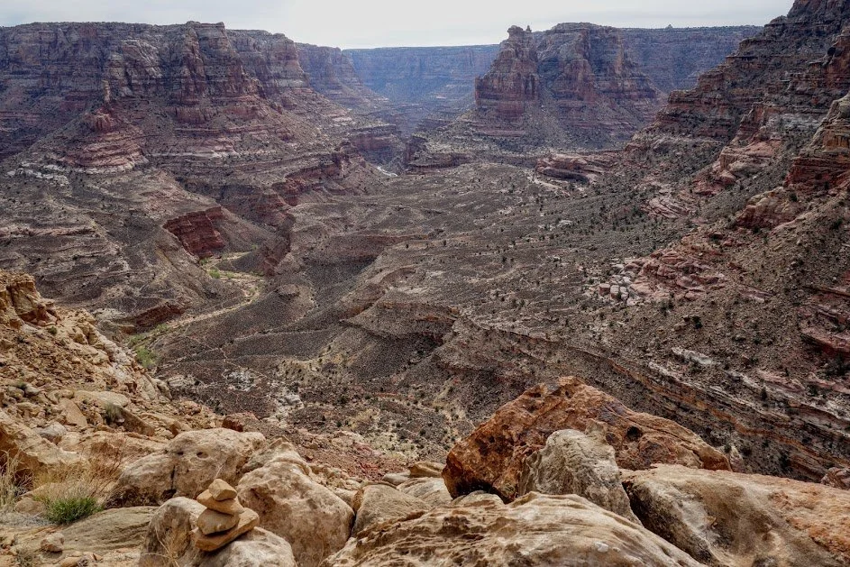
Tucked away in the remote region of Blanding, UT- this is a backpacking route for experienced adventurers. Highlights of this route include diversity including its beautiful forest, desert scenery, and rich biological, geological, and archaeological resources.
The loop often starts at Woodenshoe Trailhead and travels clockwise through Dark Canyon Wilderness. With many side excursions available, the distance and time you plan to spend out there can increase. Backpackers may opt to do shorter versions of this route and just hike out and back.
Water can be scarce depending on the season, snowmelt and time of year so it is important to call the Monticello Ranger District to find out the latest conditions and any updated trail information before you go.
#2 Coyote Gulch - Glen Canyon National Recreation Area
Distance: 13-22 miles (depending on route)
Level of Difficulty: Moderately Challenging
Elevation Gain: 1,300 ft
Best Season: Spring and Fall
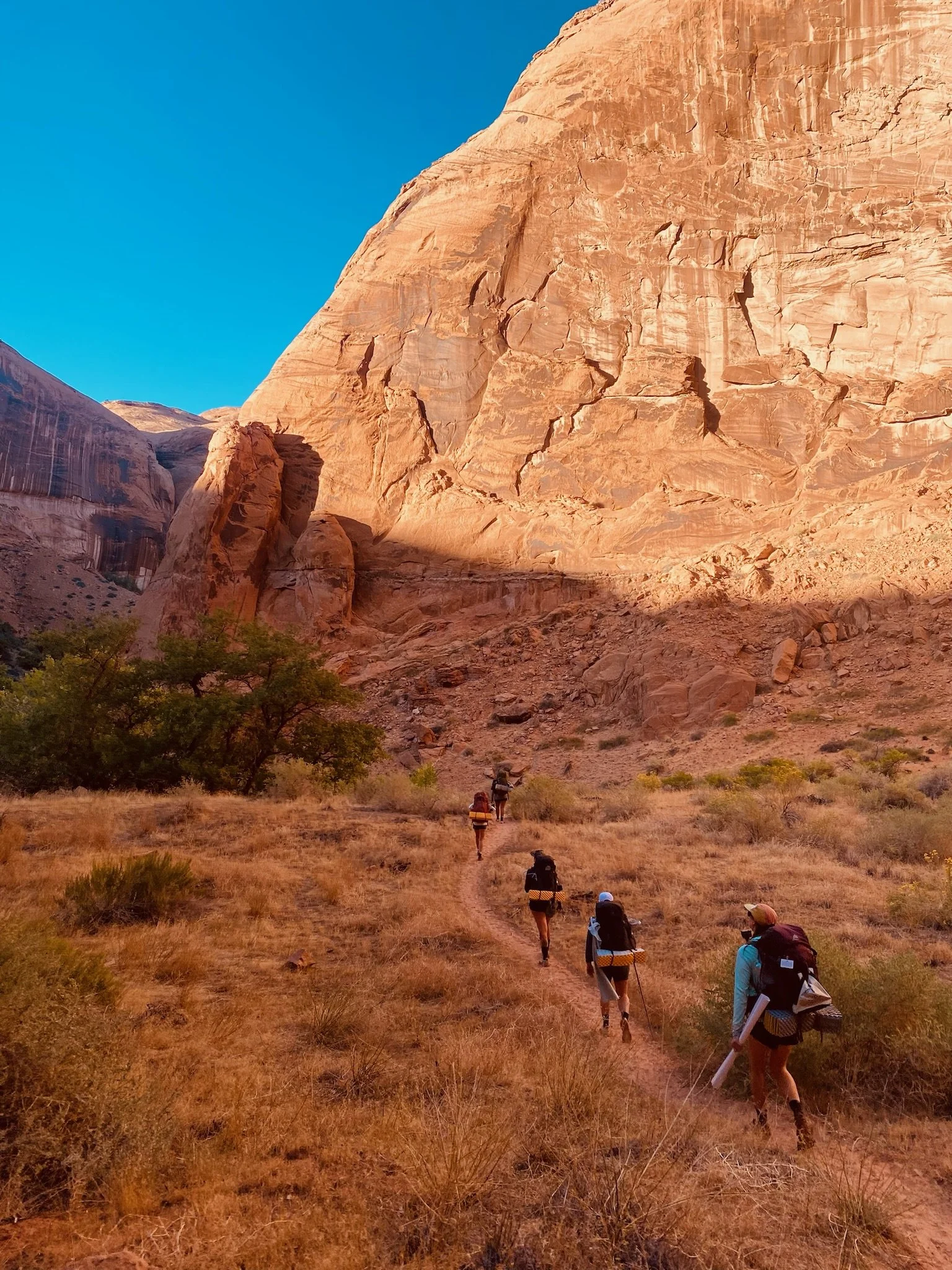
An absolute hidden gem, Coyote Gulch is located within Grand Staircase Escalante National Monument and is one of the most iconic backpacking destinations in Southern Utah.
The trail features a variety of natural wonders, including towering sandstone cliffs, cascading waterfalls, peaceful swimming holes, ancient pictographs, massive arches, and natural bridges, all set within a lush riparian environment.
From the small town of Escalante, you will drive 1.5 hours down Hole in the Rock Road. This washboard dirt road is a slow and bumpy ride.
There are many different ways to drop into Coyote Gulch Canyon so there are some options and versatility when it comes to choosing your adventure. The trailhead access points are Red Well, Hurricane Wash, Sneaker Route, and Crack in the Wall. It’s important to do your research and have good route-finding skills. The terrain is rugged and the trail is unmarked.
Red Well is the first access point off Hole in the Rock Road that you’ll encounter. 4WD is recommended. It’s the more adventurous and remote option compared to other more popular entry points. 13-15 miles depending on your exit point.
Hurricane Wash is the second access point and easiest to access with the trailhead being right off Hole in the Rock Road with parking available. It’s not overly technical making it accessible to hikers with basic backcountry experience.
Sneaker Route is a Class 3/4 rappel that offers direct access to the canyon floor, just past the iconic Jacob Hamblin Arch – a striking geologic feature renowned for its breathtaking beauty and often captured in photographs. This provides day hikers with a unique and scenic entry into the canyon.
Crack in the Wall is the final access point closest to the confluence of Escalante River. The last couple of miles to get to the trailhead is through deep sand so a 4WD high clearance vehicle is a must. There is a very short technical section where you will need to lower packs with a rope and squeeze through an 18 inch crack.
Permits are required but they are free and can be obtained at the Escalante Interagency Visitor Center or self-issued at the trailheads which is why this trip made this list!
Please check the forecast and avoid going if there is a chance of heavy rain. Coyote Gulch is a slot canyon and that means there is a risk of flash floods, especially during monsoon season (summer months).
Expedition Courage offers epic group backpacking trips in Coyote Gulch during the Spring and Fall. If you're looking to join an unforgettable adventure, check out our Utah Trips page for more details!
#3 Lake Blanche - Twin Lakes Wilderness
Distance: 7.0 miles
Level of Difficulty: Strenuous
Elevation Gain: 2,400 ft
Best Season: Summer and Fall | Late June (depending on snowmelt) - early September
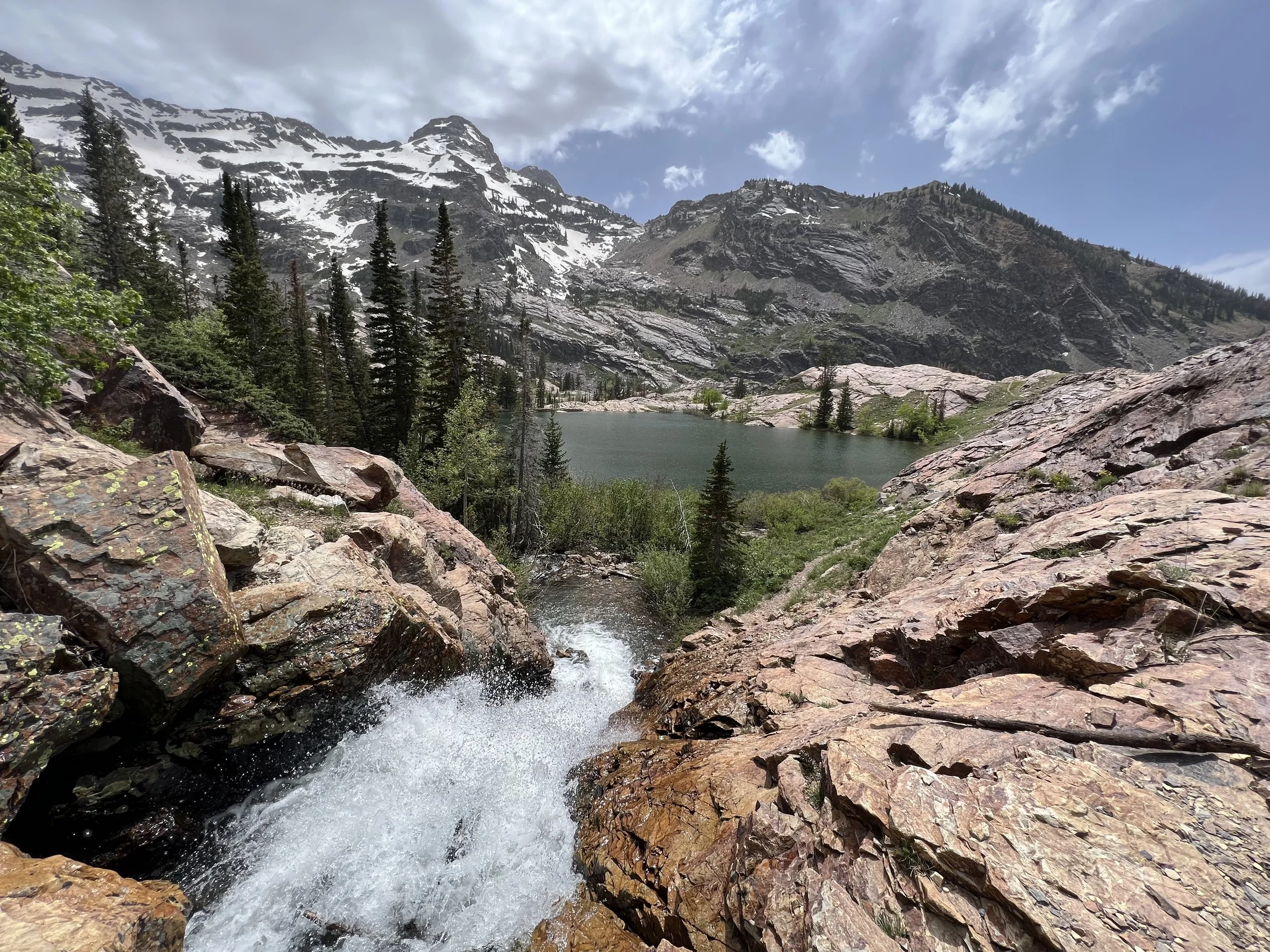
Located just outside Salt Lake City in the Wasatch Mountains, this stunning wilderness area features beautiful alpine lakes towered by mountain peaks, waterfalls, forest and an abundance of wildlife. The Lake Blanche trailhead is located just off Big Cottonwood Canyon Road.
This is a great hike if you are looking for a shorter trip so you can practice your backcountry skills. The trail is well marked and popular due to its proximity to town. You can do this as a quick overnight or stretch it out into 2 nights with a layover at the base of the lakes so you have an extra day to explore around.
Starting at around 6,000 ft elevation, you will follow the Mill Creek drainage through Aspen and Pine forests. You’ll climb almost 2,400 ft in 3.5 miles until you reach Lake Blanche. The spectacular views make it all worth it with incredible panoramic views of Big Cottonwood Canyon and the surrounding peaks.
This is a popular area for locals and visitors so expect some crowds especially on weekends. Going on weekdays and starting early can help you experience more solitude on trail and secure a decent campsite.
The breathtaking mountain views, alpine lakes, and waterfalls make this challenging hike worth the effort.
#4 : Halls Creek Narrows - Capitol Reef National Park
Distance: 22.4 miles
Level of Difficulty: Moderately Strenuous
Elevation Gain: 1,187 ft
Best Season: Spring and Fall
I’m sure you are probably wondering how a National Park trail made this list for a blog post titled “5 Backpacking Trips in Utah that Don’t Require Permits” and that is a fair observation. Well a permit is technically still required to backpack in Capitol Reef National Park however, they are free and can be picked up at the Visitor Center.
Unlike other National Parks which have the development and infrastructure geared towards large-scale tourism, Capitol Reef is focused on preserving the remote wilderness. As a result, they don’t have the same pressures as other National Parks (Zion, Grand Canyon, etc…) that need to control access and impose limits on permits to preserve the land. This straightforward permitting system attracts backpackers seeking more solitude in an isolated and serene wilderness.
To access Brimhall Trailhead you will need to travel down an unpaved dirt road with AWD and high clearance. The drive is about 2 hours from the Capitol Reef National Park Visitor Center. rugged and rough so make sure you call the park and ask for updated road conditions.
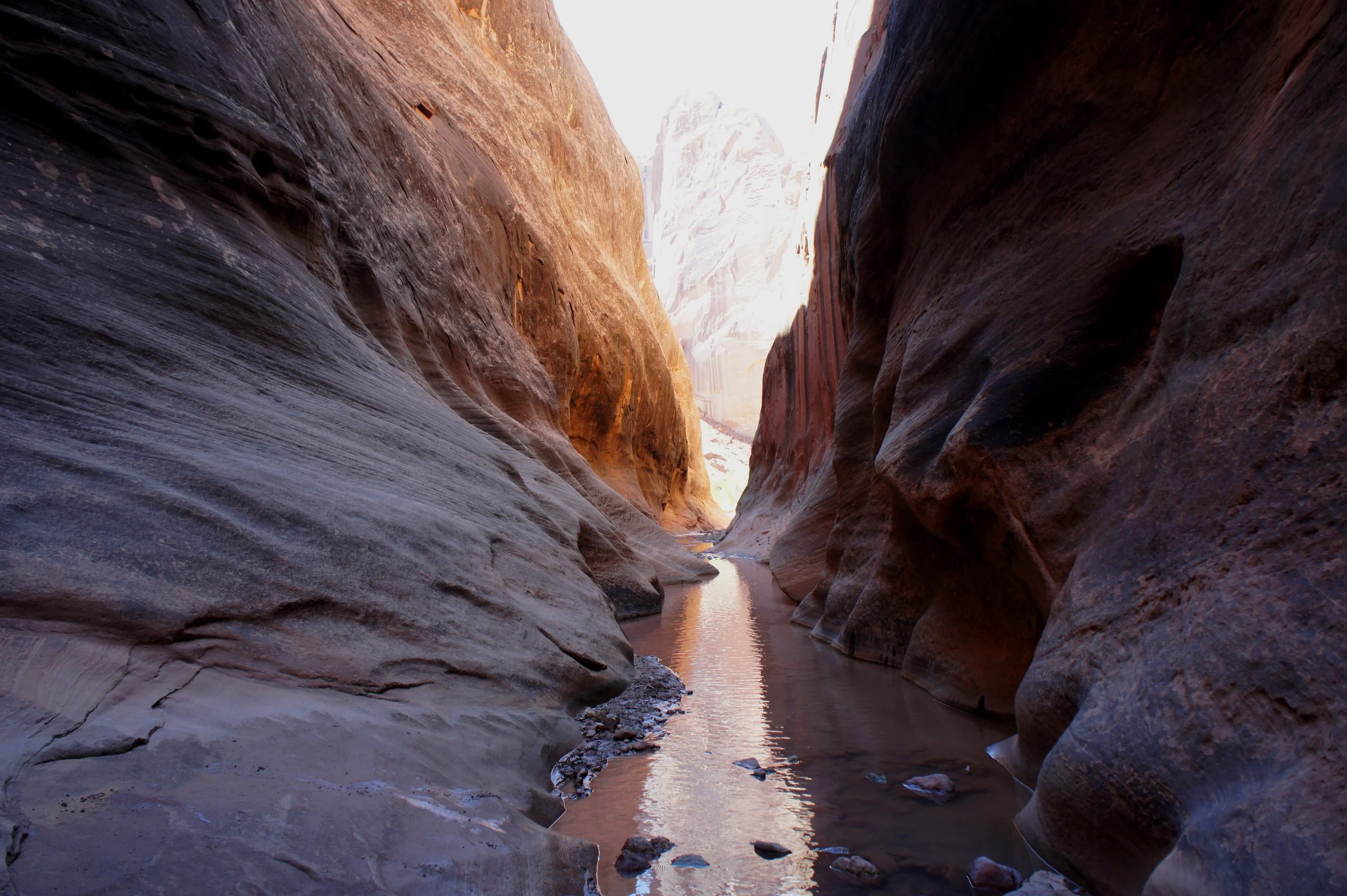
This route is off the beaten path and absolutely epic. This will feel like a true adventure as you wade through water following a creek bed and navigate narrow sections of canyon with sandstone walls towering above you. This remote area is less crowded, which makes it ideal for enjoying the peace and solitude of the backcountry.
Whenever you plan to hike in a canyon it’s important to check the weather forecast and contact the park rangers for the most updated trail conditions. Avoid hiking this trail if there is any chance of heavy rain or right after a heavy rain. Flash floods are incredibly dangerous, can occur suddenly, and are often fatal.
#5 Mirror Lake Loop - Uinta-Wasatch-Cache National Forest
Distance: 20-30 miles (depending on route)
Level of Difficulty: Moderate
Elevation Gain: 2500 ft - 4500 ft (depending on route)
Best Season: Summer (Late June through early September)
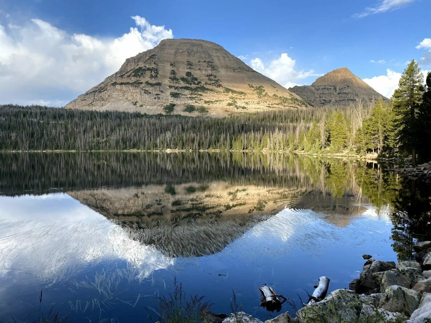
A moderate hike with stunning alpine views, crystal clear lakes, and a variety of wildlife. Mirror Lake is one of the most well known lakes in the Uinta Mountains.
The well-marked trail and gradual elevation change make it an excellent choice for new backpackers looking to hone their skills. Experienced backpackers enjoy this trail as well with many notable peaks in the area to summit. Mount Baldy (11,943) is a short distance north of the loop and can be accessed by taking a side route to the summit.
Permits are not required but you will need to pay a fee ($3 per day or $6 per week or $25 per year) to access the recreation area on Mirror Lake Scenic Byway if entering through Uinta-Wasatch-Cache National Forest. There are various trailheads in the High Uintas and some access points will require high-clearance 4WD vehicles to get to these remote routes. The easiest starting point is via Mirror Lake. Trailhead
Be prepared for rapidly changing weather in high altitude mountainous terrain. Always carry rain gear even if the weather looks clear before the start of your trip.
There are no designated campsites but you will find established campsites along the trail and Shingle Creek.

